Early Des Moines Boundary Changes
Text
In 1857 Des Moines only encompassed 8.75 sq/mi. In 1890, Des Moines increased its size dramatically to 55.1 square miles by annexing 8 surrounding communities. This was a significant increase in land and population. The boundaries for various years may be seen on the attched map (click on the linked image title, and again to see larger).
Sevastopol – incorporated in 1877
City of North Des Moines – incorporated in 1880
Greenwood Park – incorporate in 1881
Gilbert – incorporated in 1882
University Place – incorporated in 1883
Capitol Park – incorporated in 1884
Easton Place – incorporated in 1889
Files
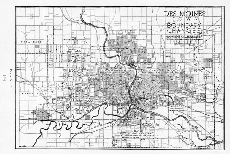
Des Moines, Iowa, Boundary Changes
Black and white zoning commission map showing Des Moines, Iowa, boundary changes and annexations. Includes the following communities annexed in 1890: City of North Des Moines, Capitol Park, Easton place, Greenwood Park, Gilbert (Chesterfield), Grant Park, and Sevastopol. | Source: Bartholomew, Harland. A Preliminary Major Street Plan for Des Moines, Iowa, 1925. Digital source: Internet Archive.
Show Comments